Customized Service Packages
Our packages are built around the ZEB Horizon Gen 2 with Vision, ensuring colorized deliverables from the start. Each includes a free site consultation, certified operation, and secure data handling. Quotes are per-acre or sq ft—reach out for tailored Muskoka pricing.
BASIC SCAN
2-4 Week Delivery
Travel within Muskoka Area
Scan of the internal and external of the Building, Scan of Topography with the area of the building
Lidar Scan Colourized
File exported in .e57 file type
(Inquire for other formats)
SCAN + DRONE PHOTOS
2-4 Week Delivery
Travel within Muskoka Area
Scan of the internal and external of the Building, Scan of Topography with the area of the building
Lidar Scan Colourized
File exported in .e57 file type
(Inquire for other formats)
10-20 Drone Images from various angles.
SCAN + DRONE + PANOS
2-4 Week Delivery
Travel within Muskoka Area
Scan of the internal and external of the Building, Scan of Topography with the area of the building
Lidar Scan Colourized
File exported in .e57 file type
(Inquire for other formats)
10-20 Drone Images from various angles.
5-10 Panoramas from Scan
SCAN + DRONE + PANOS + sCAN cLASSIFICATION
2-4 Week Delivery
Travel within Muskoka Area
Scan of the internal and external of the Building, Scan of Topography with the area of the building
Lidar Scan Colourized
File exported in .e57 file type
(Inquire for other formats)
10-20 Drone Images from various angles.
5-10 Panoramas from Scan
Recap File Setup
Recap Classified (Categorization of Ground, Building, and Vegitation into seperate Layers)
Extra services
Add on other services or features to your project
3D Video
3D video using an Insta360 x4 camera allow you to pan around in 3D.
Faster Delivery
If the scan is needed faster, we are happy to expedite the services. Please inquire with requested turn around.
Extended travel zone
Scans can be accommodated outside of Muskoka in Toronto, the GTA, Barrie, Collingwood, etc. Please inquire about the location.
Site Photos
If you require any specific photos, please let us know and we can take photos as required.
Topography Scan
Scan of topography around the property, including converting the scan into contour lines.
Building Scan
Scan of the Building inside and outside, including relationship to topography.
FAQ
ask us
anything
What is Lidar
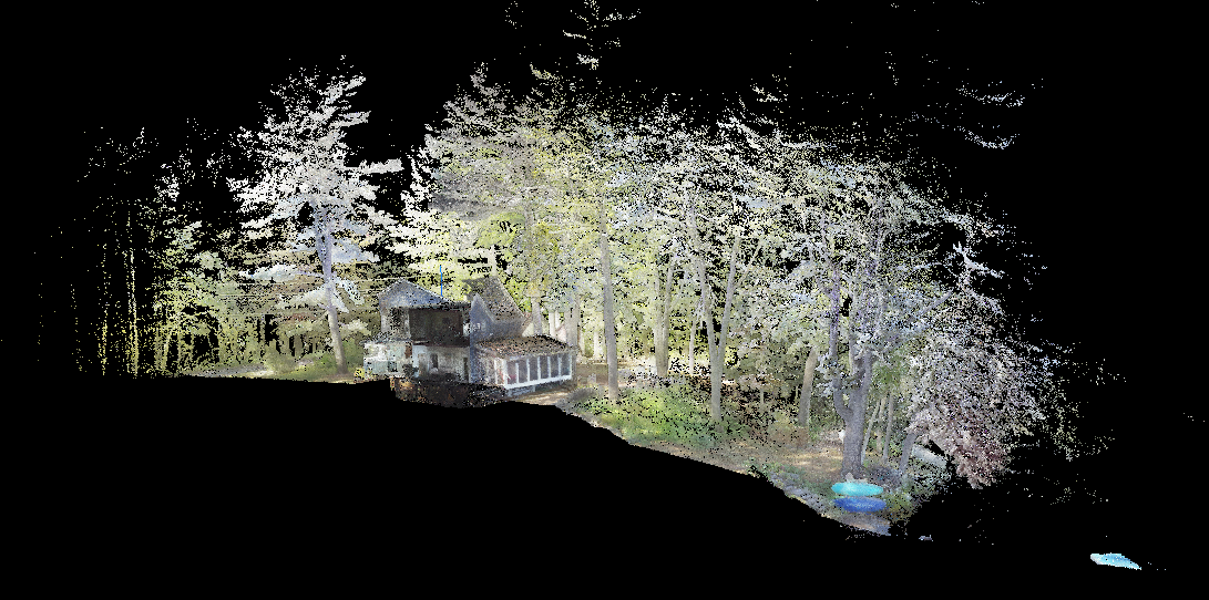
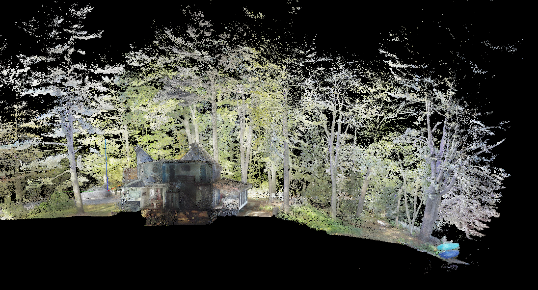
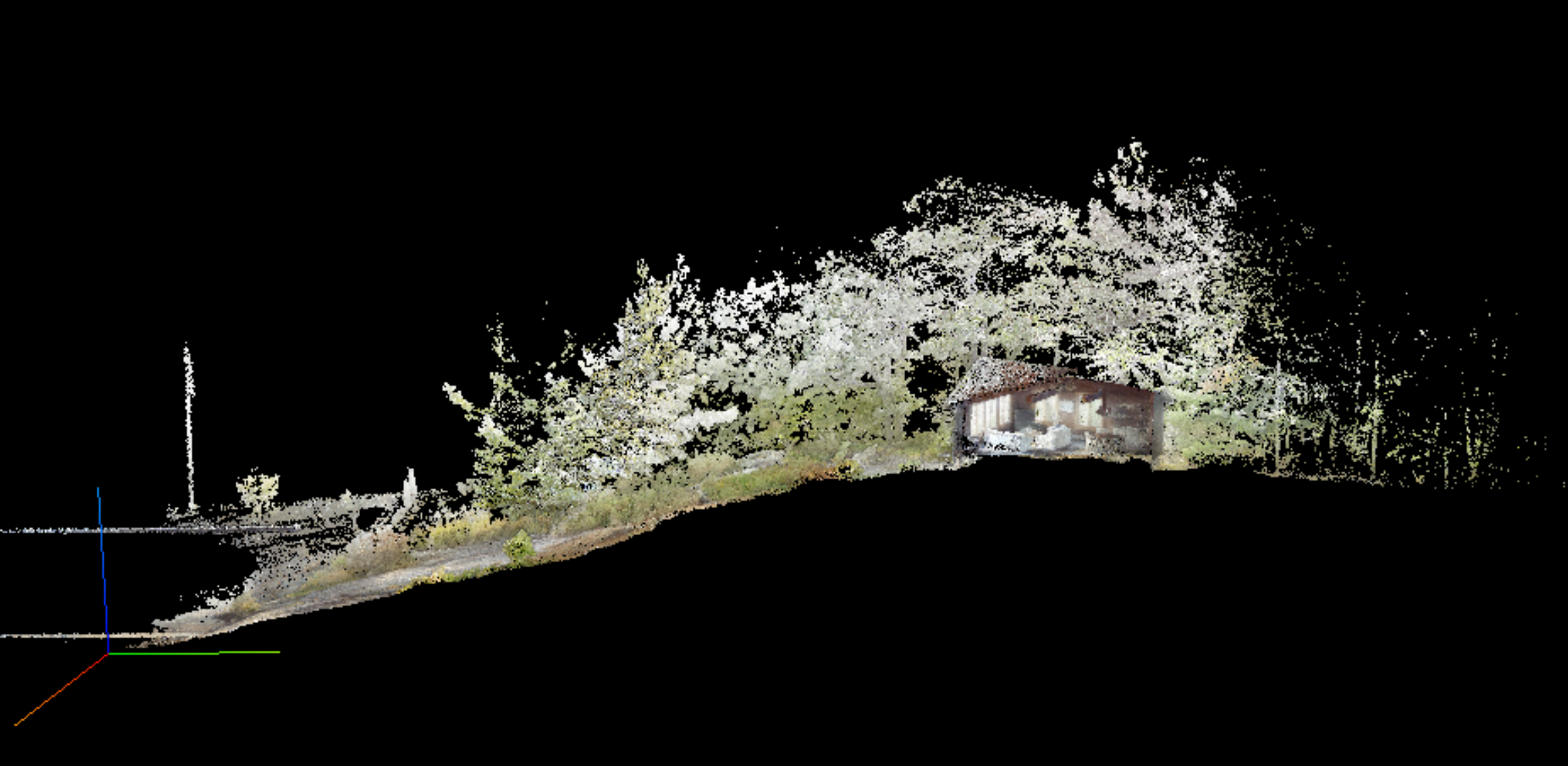
LiDAR (Light Detection and Ranging) is a cutting-edge technology that uses laser pulses to measure distances, creating precise 3D models of environments. At Muskoka 3D Scans, we use the GeoSLAM ZEB Horizon Gen 2 with Vision to harness LiDAR for fast, accurate, and site-specific data collection.
- High-Precision LiDAR: Emits 300,000 laser points per second over a 100-meter range, achieving 6mm accuracy to capture as-built conditions, topography, and trees.
- SLAM Technology: GeoSLAM’s real-time mapping works without GPS, perfect for Muskoka’s forests and lakefronts, creating seamless point clouds as the operator moves.
- ZEB Vision Colorization: Adds 4K panoramic imagery to point clouds, delivering photorealistic models for intuitive design in Revit, AutoCAD, and more.
- Versatile Outputs: Produces E57, LAS, or OBJ files, supporting BIM, topographic contours, and VR walkthroughs for engineers, architects, and builders.
This technology ensures rapid, reliable scans that transform how you design and build in Muskoka’s unique landscapes.
Can the Scan be Viewed with Free Software
There is a software called Cloud Compare that can be used to view the scan data.
How do your services benefit my project?
Our scans provide sub-centimeter accuracy, reducing design errors and construction revisions. They enable site-specific planning, streamline permitting, and support BIM workflows, saving time and costs for engineers, architects, and builders.
Do I need to prepare the site before scanning?
Minimal preparation is needed. Our handheld scanner navigates around obstacles like trees or structures. We recommend clearing any temporary debris for optimal results, but we’ll guide you during the free consultation.
Still Have Questions?
We’re here to help you understand how 3D scanning can transform your Muskoka project.